

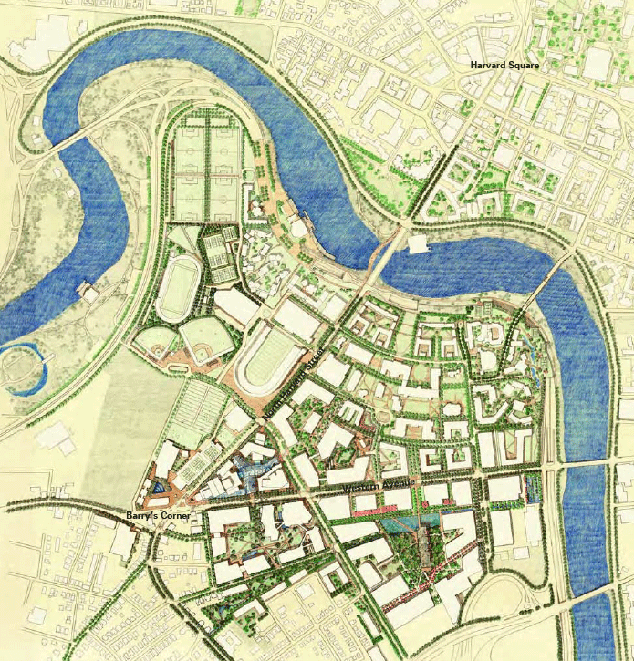
This is Harvard's illustrative design of how they envision North Allston in fifty years. The images on this page are courtesy of Harvard University’s design team who put together the Institutional Master Plan, which was presented for the Boston Redevelopment Authority (BRA) in order to seek zoning approval for the projects. As defined by the BRA, an Institutional Master Plan is a “comprehensive development plan that describes an institution’s existing facilities, long-range planning goals, and proposed projects.” Harvard must update and renew it’s IMP periodically and must amend it whenever a change or addition is proposed or required by either its own design firm or by the BRA. The BRA will then use the IMP to define how it assigns zoning permits for individual projects, based on the long-term goals of the plan.
North Allston resident, Harriet Kotomori, describes how Harvard first started coming into the neighborhood
![]()
Harvard's History of Urban Re-Development
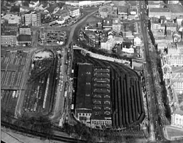
Once an MBTA industrial park, Harvard's Kennedy School of
Government is an example of urban redevelopment
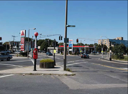
Barry's Corner, as it is known, is a barren and rather dangerous major intersection in North Allston
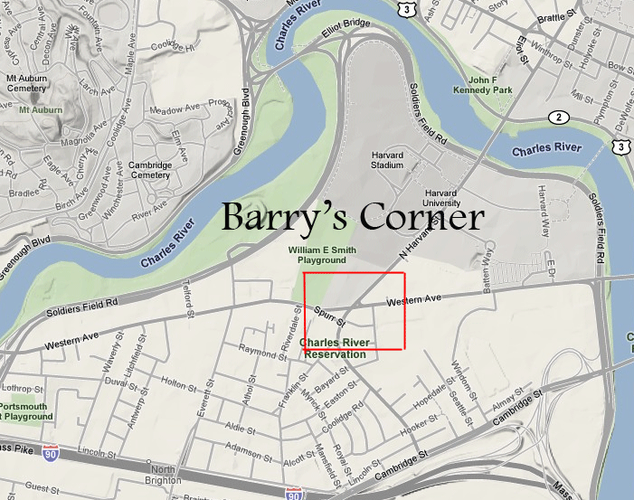
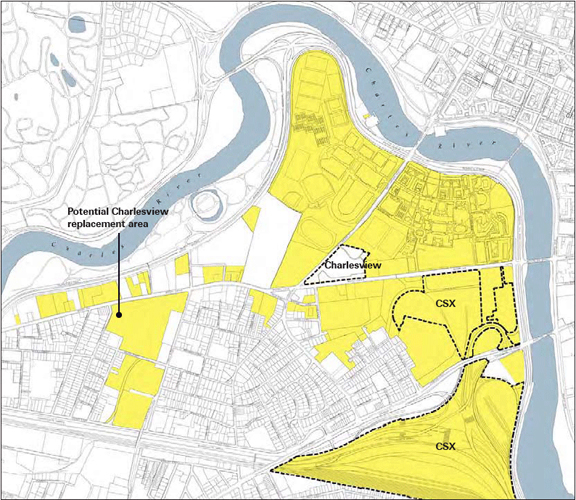
This is the plan Harvard has for the Barry’s Corner area of North Allston. This corner is the intersection of Western Avenue and North Harvard Street, and is the main traffic artery for North Allston, which connects Watertown and Newton from the west to Cambridge and other points north and east across the Charles River. Currently, this area is devoid of major commercial activity, and is a dangerous and congested intersection. Harvard intends to design a Harvard Square-like commercial and residential area, as well as make it a cultural center for North Allston.
In the late 1960’s, this Barry’s Corner area was “reclaimed” by the Boston Redevelopment Authority, under eminent domain, and long standing residential houses were demolished so that Charles View Apartments could be built. Charles View is a low-income, high density residential area, the only of its kind in North Allston.
North Allston resident, Ed Kotomori, recalls Barry's Corner history and the BRA's act of eminent domain
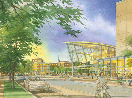
Harvard's plan to redesign Barry's Corner intersection
![]()
Around the Harvard Stadium, between North Harvard Street and Western Avenue, Harvard intends to build several university buildings and dormitories, creating a high density area in the center and northsections of N Allston. Currently, this is where Charles View Apartments is located.
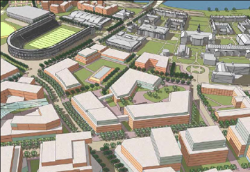
Between Western Avenue and Cambridge Street, where there is light industry today, Harvard hopes to build green space as well as university complexes, including a Science Complex, which will be a set of buildings ten stories high that will serve as the primary science center for the University.
![]()
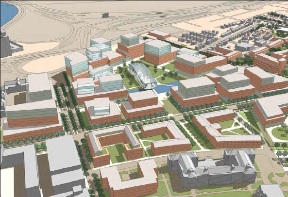
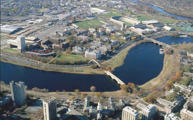
Harvard on the Charles
Along the Charles River, Harvard hopes to be able to construct a pedestrian way over Soldiers Field Road, which currently traces along the river and is a major thoroughfare and artery into the city of Boston, yet it cuts North Allston off from potentially prime riverfront property. If granted by the Boston Redevelopment Authority, Harvard may completely transform the North Allston riverfront, creating a greenspace where there is now only currently freeway and industry. The entire section of the city could be redeveloped within the next fifty years to become one of the most attractive and vibrant urban spaces in Boston.
Local business owner, Paul Sager, talks about Harvard's economic influence in the area